- January 21, 2023
Joshimath land displacement been happening continuously: Satellite imagery analysis

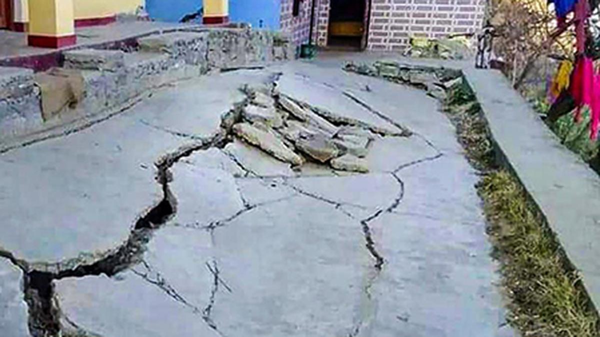
Cracks appear as the land sinks around a house in Joshimath, Uttarakhan. File
| Photo Credit: Special arrangement
While the recent damage to houses and structures in Joshimath have brought widespread attention to the land subsidence, several experts say that geological changes affecting the town’s topography have been under way for many years.
An NRSC-ISRO report — that showed that Joshimath sank by 5.4 cm between December 27, 2022 and January 8, 2023 — sparked controversy and was taken down by the organisation after gag orders from the National Disaster Management Authority.
Dave Petley, a landslide expert and Vice Chancellor at the University of Hull in the U.K. quoted an analysis posted on a blog — authored by remote sensing and landslide experts at the Aristotle University of Thessaloniki, the Earth Science Observatory and School of the University of Strasbourg and the National Center of Scientific Research — which showed, via satellite measurements, that the surface displacement rate in Joshimath was between 3 cm and 10 cm per year (at different locations) over the past four years. It maintained that the Himalayan town is ‘sliding’.
The authors of the analysis, including geomorphologist Jean-Philippe Malet, claimed to have used satellite imagery and analysis based on the InSAR (Interferometric Synthetic Aperture Radar) to demonstrate the ‘sliding.’ InSAR is a technique used for mapping ground deformation using radar images of the Earth’s surface that are collected from orbiting satellites.
The Hindu has reached out to Mr. Malet for further details.
‘Areas moving at different velocities’
The conclusion of the analysis is that a clear deformation signal is visible at the town of Joshimath as well as on the opposite slopes, while the rest of the region seems relatively stable. It further added that it appears that two zones of the town have been continuously moving in the past four years, since 2018, on the downhill part of the slope.
Talking to The Hindu, Wolfgang Schwanghart, a geomorphologist from the University of Potsdam (Institute of Environmental Science and Geography) said that the analysis by the Aristotle University and CNRS-EOST researchers shows that different parts of the Joshimath area are moving at different velocities. The data dates back to 2018 and movements have perhaps been going on for longer than that. Some areas have experienced an acceleration of the movements since early 2022.
The analysis added that the surface displacement rates are higher in the eastern part of the slope with a value exceeding 10 cm per year and a second zone is also visible on the western side with displacement rates of up to 3 cm per year. The rest of the slope, mostly in the upper parts, shows lower average velocities of less than 2 cm per year.
“The values are averaged over larger areas, and hence, we cannot exclude that some areas have remained stable while others have moved at a more rapid pace which might explain why some buildings were more severely impacted than others. The authors provide important data to understand the kinematic behavior of the landslide, thus providing crucial information that hopefully leads to a better understanding of its causes,” he added.
‘Landslide prone’
Mr. Schwanghart is himself the co-author of another study, done by Indian and international scientists in 2022, which states that that over 300 “fully or partially road-blocking landslides” have been identified between Rishikesh and Joshimath, a 250 km stretch that passes between Tehri, Pauri, Rudraprayag and Chamoli districts of Uttarakhand. The study is currently under review for publication.
The road in the given stretch is strongly affected by landslides which has been previously described and attributed to the region’s fragility of slopes, focused rainfall and frequent seismicity, said Mr. Schwanghart.
According to the government’s assessment, over 863 houses in the town were found damaged till Friday, among which 181 were in the danger zone. Over 900 people have been rehabilitated by the State government in temporary shelter homes since January 5.


